The Mengiong – Gaat FMU has a total licensed area of 92,179 Ha, forming part of Protected Forest or part of Baleh Protected Forest (56% or 20,295 Ha) and part of the Kapit Stateland Forest (44% or 15,796 Ha) in the northern portion of the licence area. The concession area is lying in between Batang Baleh in the northern, Sg. Mengiong flows through the center of the areas, Sg. Gaat in the western and Sg. Melatai bounded in the east and cut line in the northeast and ridges dividing the tributaries of Sg. Mengiong and Sg. Entuloh in southeast.
The FMU area covers a total area of 36,091 Ha. This Mengiong – Gaat FMP will be divided into 25 coupes and 56,088 Ha will be excluded from the FMU which consist of Baleh HEP dam construction inundated zone, 100 m buffer zone reserved along dam inundated areas, salvage logging areas and conservation area.
The Mengiong – Gaat FMU was previously part of Rajang Wood Sdn. Bhd. under FTL No. T/3024 which was first issued to STIDC (Piramid Intan Sdn. Bhd.) under FTL No. T/3401 on 12th April, 2001 and expired in 11th April, 2022.
The Mengiong – Gaat FMU is a re-entry hill timber Mixed Dipterocarp Forest.
The Locality Map of the Mengiong – Gaat FMU:
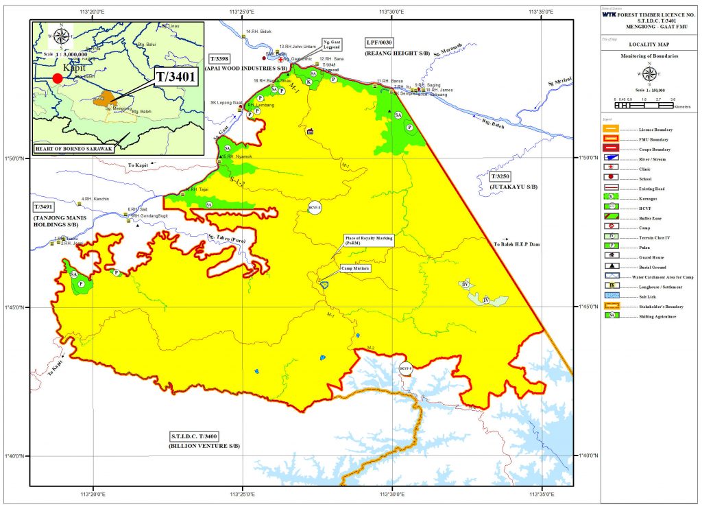
The FMU can be reached by road from Sibu Town, which is about 102 km upstream from Kapit Town.
The altitudes of Mengiong – Gaat FMU is ranging from 250 feet in the Northern part at the lower hill areas to 2,250 feet at highest spot at the mid-center tip above sea level next to Juta Kayu Sdn. Bhd. timber licence area – Ulu Sg. Mengiong and Sg. Gaat, Batang Baleh Sarawak.
The FMU is mainly covers by Terrain Classes (MDF II, III and IV), only few areas have steep dissected terrain with slope greater than 35o or Terrain Class IV which is too steep for conventional bulldozers based logging. The region has a tropical type of climate affected by the monsoon seasons, which is generally hot, wet and humid throughout the year.
There are 18 kampung/longhouses found inside or adjacent within 5 km radius from the area or as identify affected communities (IAC). According to EIA report, there are 18 longhouses but some of them were located beyond radius of 5 km. As such, the area has been encroached by SA in the concession in sporadic patches by the local communities in the riverine or valley of undulating to flat areas.